
The Thomas Fire, ignited on December 4, 2017, stands as a poignant reminder of the devastating impact wildfires can inflict on communities, with over 280,000 acres ravaged and thousands of structures leveled. The effective rescue of residents during this catastrophic event was the result of meticulous planning and the implementation of coordinated strategies among emergency services, robust communication tactics, and the deployment of firefighting resources. In the chapters that follow, we will delve into the evacuation strategies that facilitated the timely relocation of residents, the seamless coordination among emergency services that ensured rapid responses, the innovative public communication tactics that informed residents, the extensive firefighting resources that played a critical role in managing the crisis, and the lessons learned for future recovery. Each chapter will weave together to provide a holistic understanding of how individuals were rescued and the collaborative effort required to safeguard lives in the face of disaster.
Racing the Ember Storm: Rescue, Evacuation, and Community Action during the Thomas Fire
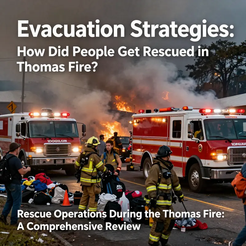
The Thomas Fire began as a whisper of smoke in early December 2017 and exploded into a roaring blaze that would etch itself into Southern California’s memory. It burned across the terrain of Ventura County with a speed that tested every assumption about wildfire behavior. The Santa Ana winds, dry fuels, and urban-wildland interfaces created a perfect storm where containment lines shifted hour by hour and evacuation routes became routes of survival. In those critical days, the question of how people got rescued was not answered by a single plan but by a mosaic of official orders, improvised acts of courage, and the stubborn resilience of communities that had learned to read danger in the landscape and act with astonishing urgency. By the peak of the crisis, more than 300,000 residents were evacuated—a number that testifies to the scale of the effort and the raw pace of the threat. The emergency management apparatus that day was less a static system and more a living organism, pulling in local, state, and federal resources, coordinating crews on the ground with aerial support, and pressing communications channels into service to reach people who might otherwise have made fatal miscalculations or been overwhelmed by fear and confusion.
To appreciate how rescues happened, one must first understand the channels through which warnings and orders traveled. Official directives and evacuation mandates formed the backbone of the response, but they existed alongside a flood of information from local media, social networks, and door-to-door efforts by first responders and volunteers. The array of tools mattered as much as the content of the warnings themselves. Reverse 911 calls could locate households and push updated routes and shelter information to phones in seconds, while local radio and television stations provided continuous coverage that small communities relied on when electricity flickered or phone signals wavered. Social media, with its rapid dissemination and citizen eyewitness reports, both amplified warnings and carried the weight of rumors, making careful management of information a parallel mission to the firefight itself. In this milieu, evacuees were navigating a map of danger in real time, where the ground could shift beneath the feet of those who thought they had a clear plan to leave and reach safety.
The response required a choreography of manpower and technology. Thousands of firefighters fought the blaze on the ground, supported by aerial resources that included helicopters and large air tankers dropping water or retardant to slow advance and protect critical corridors. The coordination was not merely about stopping the flame but about creating passageways for people to move away from danger and toward safety. Shelters, temporary reception centers, and partner sites sprang into service as the fire room expanded and then contracted with shifting winds and weather. Yet the most poignant image of rescue in those days was not a controlled operation at a command post but the human drama playing out in garages, on quiet cul-de-sacs, and along the edges of burned landscapes. Survivors relied on a mosaic of formal guidance and informal support that could be found in the generosity of neighbors, the quick thinking of strangers, and the willingness of communities to open their doors to people in crisis.
Among these stories, a particular rescue stands out as a symbol of how improvisation and compassion intersected with formal response. A man named Tommy, badly overwhelmed by smoke inhalation yet still conscious enough to grasp a thread of hope, was found by Good Samaritans who saw him collapse near a road and chose to act. They used a trailer to transport him, carrying him toward a place they believed would provide immediate medical care and safety. Their route took him to the Humane Society of Ventura, a location not designed as a formal triage center, but one that functioned as a lifeline because it offered shelter, medical attention, and a radiant signal of possibility when escape felt almost impossible. Tommy’s rescue is emblematic of a broader pattern: non-traditional shelters and community networks becoming informal triage points, where people could stabilize, receive basic care, and continue toward more formal medical treatment as needed. It is a reminder that in a wildfire, rescue is not only the capture of a person by a fire engine or a helicopter crew; it is the mobilization of trust, improvisation, and the social fabric that can carry someone through the very last step to safety.
The wider literature on evacuation behavior helps illuminate why these kinds of acts mattered so much. A growing body of research has begun to dissect how people decide to evacuate in the face of uncertainty, danger, and conflicting information. A notable 2026 study of the 2019 Kincade Fire used machine learning to identify the interplay between various factors in evacuation decisions. The analysis found that pre-fire safety perception—the community’s sense that they understood the risks and had practiced a plan—was among the most influential predictors of whether people chose to leave. Others included the presence of an official evacuation order, a person’s perceived risk at home, and education level. Taken together, these factors suggest that the most effective evacuation outcomes emerge when authorities pair clear, timely directives with ongoing public education and channels that communities already trust. The Thomas Fire offers a lived example of how those factors play out in the wild, where timing can determine whether a driver makes it to the next intersection or finds themselves blocked by a wall of flame or traffic. In practice, the incident showed that people do not only follow orders; they reinterpret and supplement them through neighborhood networks, family routines, and impromptu decisions under extreme pressure.
In oral histories and after-action reports, survivors repeatedly cited the role of local networks and spontaneous acts of kindness. One recurring thread was the willingness of neighbors to alert others, share fuel and resources, or guide relatives through perilous routes when official lines of communication were jammed or delayed. The Thomas Fire underscored a truth that many wildfire researchers emphasize: evacuation is not a single moment but a process that unfolds across hours and, in some cases, days. The process relies on a dynamic balance between authoritative guidance and the practical knowledge embedded in local communities. It requires not only efficient command-and-control but also the social capacity to organize quickly when formal systems are strained. In that sense, rescue during the Thomas Fire was as much a social achievement as it was a logistical one; it depended on the ability of strangers to step forward, interpret risk, and act decisively when every second counted.
This synthesis also invites reflection on the vulnerabilities that make evacuation challenging. The Thomas Fire traversed rugged terrain and complex neighborhoods, where roads narrowed into canyons, brush burned with intensity, and congestion turned escape routes into bottlenecks. In such settings, the determination of individual households to evacuate often depended on personal risk assessment, access to transportation, and the efficiency of neighbors’ outreach. The lessons from this period point toward the need for both robust, scalable official alerts and reinforced community resilience. That means continuing to invest in education about wildfire risk, ensuring that official directives arrive with practical, actionable steps, and acknowledging that non-traditional support structures—animal shelters, faith-based groups, and civic organizations—play a crucial role in a comprehensive rescue ecosystem.
As the fires eventually subsided and the smoke cleared, the public conversation turned to recovery and risk management in the urban-wildland interface. The post-fire environment posed new hazards, most notably the risk of mudslides in burn scars after rainfall. The Thomas Fire demonstrated that wildfire response does not end when flames are extinguished; it evolves into a multi-hazard crisis that demands integrated planning, improved risk communication, and sustained public engagement. Communities began to reevaluate evacuation routes, shelter locations, and the timing of alerts in order to minimize the likelihood that residents would be caught unprepared when the next threat materializes. The experience reinforced the value of transparent, steady communication that can adapt to rapidly changing conditions, a standard that should guide future emergency planning in wildfire-prone regions.
In linking the Thomas Fire to broader research and practice, it is helpful to consider how lessons from this event connect with ongoing debates about evacuation reliability and equity. If public education, trust in authorities, and timely, accurate information are the bedrock of successful evacuations, then resilience must be built before a crisis begins. Communities need repeated, practical guidance about how to leave, where to go, and what to bring. They also require reliable means of staying informed when roads are compromised or radio signals are interrupted. The Thomas Fire’s rescue narratives show that when communication channels work in harmony with on-the-ground action, people can escape even in the most precarious conditions. Conversely, when gaps appear in alert systems or when information flows too slowly to reach vulnerable residents, the risk of harm increases, particularly for seniors, non-English speakers, and households with limited mobility. This is precisely the kind of insight that informs the ongoing refinement of evacuation strategies, including the push toward more inclusive messaging and the expansion of multi-channel alerts that reach people across different platforms and circumstances.
For readers who want to explore a broader discussion of evacuation challenges and how they shape outcomes in complex wildfires, a related resource investigates the California-specific context of evacuations and the factors that influence whether residents leave in time. See California Wildfire Evacuation Failures for a critical examination of where official plans succeed or fall short in practice. California Wildfire Evacuation Failures
As this chapter moves toward its close, it remains clear that rescuing people during large wildfires like the Thomas Fire required more than brave firefighters and efficient engines. It required communities to act as a network—neighbors looking out for neighbors, strangers offering shelter, and ordinary people converting personal risk into shared survival. It demanded a public that understood risk, trusted the messages it received, and felt empowered to take action when time ran short. It also called for researchers and policymakers to build on those lessons with rigorous data, better forecasting, and a more humane approach to evacuation planning. The Thomas Fire, in all its ferocity and complexity, thus stands not only as a record of loss but as a rich case study in resilience—an example of how rescue and evacuation unfold at the intersection of science, policy, and human kindness.
For further reading on how theThomas Fire was covered and how rescuers and survivors recounted their experiences, see the detailed reporting by NBC News, which documents the varied paths to safety and the human stories that defined the crisis. https://www.nbcnews.com/news/us-news/thomas-fire-people-rescued-november-2017-145321
Coordinated Courage: The Multilayered Rescue Effort Behind the Thomas Fire
The Thomas Fire unfolded with a ferocity that demanded more than individual heroism; it required a tapestry of coordinated actions that stretched across agencies, jurisdictions, and communities. Beginning in early December 2017, the fire roared through Southern California under Santa Ana winds, fueled by bone-dry vegetation and tinderbox conditions. The scale was staggering: hundreds of thousands of residents faced evacuation warnings, countless homes and structures were imperiled, and responders had to move with unprecedented speed to outpace the advancing flames. In that crucible, rescue and relief did not hinge on a single heroic act but on a tightly choreographed system designed to adapt as the fire moved. The overarching lesson was not merely about how to deploy a fire hose more efficiently, but about how to knit together planning, technology, manpower, and community trust into a single, flexible response. The result was a rescue operation that prioritized public safety, clear communication, and the seamless integration of human and technological resources.
To understand how people were saved, one must begin with the backbone of the operation: evacuation orders and public alerts. Authorities recognized early on that a wildfire of this magnitude could outpace traditional emergency calls and individual decisions. They leaned on a multi-channel strategy that combined emergency alert systems, local media broadcasting, social media updates, and door-to-door notifications in neighborhoods where rapid evacuation was essential. The goal was to reach every resident, including those without immediate access to digital devices or those living in stair-stepped subdivisions where roads began to choke under smoke and heat. Evacuation signals were precise, with zones defined by fire behavior forecasts and real-time reconnaissance. This multi-channel approach was crucial because the fire’s rhythm could change in minutes, driven by shifting winds and drying fuels. The result was a marked reduction in confusion and a clearer path for thousands to reach safety before flames cut across escape routes.
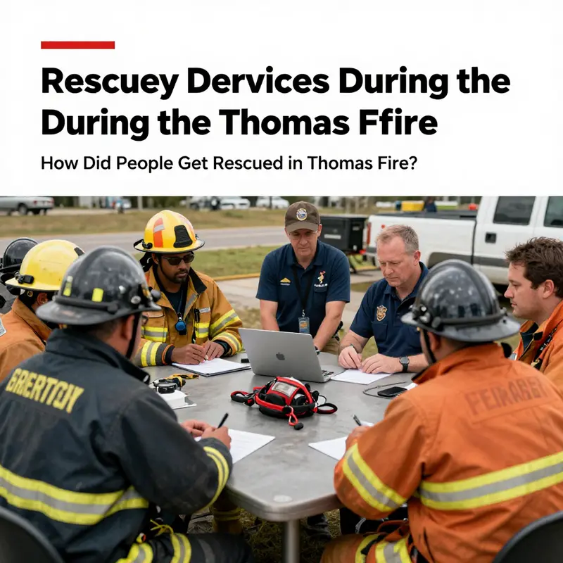
The resilience of the response rested on the people and institutions charged with delivering it. Local fire departments and Cal Fire formed the core of the operational backbone, but they drew strength from a broader coalition that included the National Guard, law enforcement agencies such as the California Highway Patrol, and federal partners through FEMA. This interagency collaboration was not improvised on the fly but anchored in an Incident Command System (ICS) that allowed for real-time resource tracking, unified decision-making, and a shared language across all agencies involved. The ICS framework enabled commanders to allocate fire engines, law enforcement escorts, and medical teams with a level of coordination that few events can match. The alignment extended to logistics hubs where fuel, equipment, and supplies were funneled to the most critical fronts, so responders could sustain operations even as conditions deteriorated. In this setting, every success depended on how well agencies synchronized their actions under pressure, rather than on any one agency’s capabilities alone.
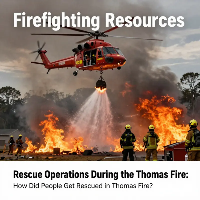
Aerial power provided a dual-purpose edge: fighting the fire and saving lives. Air support dominated the sky with helicopters and air tankers delivering water and retardant to suppress spread and create safer corridors for ground crews. Air ambulances staffed by medical specialists moved injured residents to hospitals when access on the ground was blocked by heat, smoke, or collapsed infrastructure. In the most challenging pockets—ridges, canyons, and burned-out roads—high-altitude sorties and careful sling operations were often necessary to reach people stranded by the advancing flames. The synergy between air and ground crews was not merely about speed; it also reduced the burden on overwhelmed neighborhoods that might otherwise be cut off in the lines of communication. Ground rescue teams supplemented this aerial reach through meticulous sweeps of high-risk zones, with firefighters and search-and-rescue specialists conducting door-to-door checks for residents who could not evacuate on their own due to age, disability, or lack of transportation.
Shelter and care formed another pillar of the rescue ecosystem. As fire frontlines shifted, evacuation centers—established at community centers, schools, and stadiums across Ventura and Santa Barbara counties—offered more than temporary housing. They became hubs of medical care, nutrition, and emotional support, staffed by volunteers and professionals who coordinated with social services to track needs ranging from medication to infant supplies. The centers also provided a space for guardians to arrange transport for dependents or loved ones who required ongoing medical monitoring. The human dimension of these centers—where a frightened family could find a stable routine in the midst of chaos—proved essential for sustaining endurance across days of crisis. The municipal and county partners worked to ensure that the centers remained accessible by public transit and that accommodations were inclusive, including provisions for seniors, people with disabilities, and non-English speakers. A sense of shared purpose emerged as shelter staff and volunteers welcomed evacuees with respect, patience, and practical assistance, underscoring that the rescue effort was as much about dignity as it was about extinguishing flames. To acknowledge the particular needs of the most vulnerable, dedicated outreach and support teams operated within the shelter network, coordinating with community organizations to bridge gaps in care and information. This integration was a reminder that rescue is not limited to a narrow set of protocols but expands to the relationships forged between responders and residents in the hardest hours of a disaster. For seniors and others who could not evacuate unaided, a number of targeted programs and community partners were mobilized to help with transportation and in-shelter care. These efforts are explored in greater depth by partners focused on elder safety and wildfire response. California Wildfire Emergency Response for Seniors.
As the fire carved a perilous path through the landscape, technology and data became the third critical thread in the rescue tapestry. Real-time data collection and analysis underpinned every decision. Incident Command Systems were linked to geographic information systems, permitting managers to visualize fire perimeters, forecast movement, and anticipate where the next evacuation would be required. Drones and satellite imagery provided eyes where ground teams could not safely go, revealing hidden pockets of people trapped in canyons or along burned-out roadways. These tools allowed incident commanders to deploy resources with surgical precision, balancing the urgency of immediate rescues against the longer-term needs of communities likely to be cut off for days. The combination of predictive modeling, live weather feeds, and fire behavior analysis created a dynamic portrait of the crisis that could adjust to evolving conditions. In practice, this meant responders could reposition search teams before flashovers, pre-stage medical assets near anticipated evac routes, and coordinate with air operations to keep corridors open for those who needed to be evacuated in the most precarious terrain. The result was a rescue operation that felt less reactive and more anticipatory, a crucial shift when speeds of spread could outpace almost any manual effort, if not the collective intelligence of the responding system.
Community energy and neighborly accountability also mattered. The largest rescues often began in neighborhoods where neighbors alerted each other, shared rides, and temporarily sheltered those who could not move. Local organizations and volunteers filled gaps left by formal resources, driving people to shelters, delivering meals, and offering emotional support in the wake of smoke-filled skies and shattered routines. This ground-level cohesion—where a resident would help an elderly neighbor navigate a maze of blocked streets or drive a vulnerable person to a shelter—illustrated the social infrastructure that often determines whether a person survives a disaster. It also highlighted the importance of planning at the neighborhood level, where block-by-block networks can translate the high-level strategies of state and national agencies into practical, immediate actions. The Thomas Fire demonstrated that resilience is a continuum: quick evacuations and well-timed alerts save lives in the moment, while long-term community-based collaboration preserves safety and reduces risk in the days and weeks that follow.
Yet no chapter of rescue is complete without acknowledging the challenges and the hard-won lessons that inform future practice. The fire’s rapid spread outpaced many initial efforts to communicate with everyone simultaneously. Even with robust alert systems, some residents remained unsure of safe evacuation routes or were overwhelmed by the pace of change on the ground. This reality underscored the need for ongoing investment in accessibility, multilingual messaging, and adaptable evacuation planning that accounts for mobility-impaired populations and complex urban-wildland interfaces. The post-fire period carried its own hazards, as heavy rains tested burn-scar stability and threatened mudslides that could threaten both survivors and responders returning to what remained of their homes. The experience reinforced a broader understanding that disaster response must anticipate multi-hazard risks and incorporate adaptive risk communication that can pivot as conditions change. The emphasis on preparedness, interagency training, and cross-cutting partnerships—between fire agencies, law enforcement, public health, and community groups—became a cornerstone of the region’s approach to wildfire resilience. The Thomas Fire thus offers more than a chronicle of a single emergency; it provides a blueprint for how to mobilize people, technology, and institutions in service of life, safety, and recovery. For in-depth detail, readers can consult the official Cal Fire incident report.
In synthesizing the events, the rescue narrative of the Thomas Fire emerges as a testament to coordination over chaos. The convergence of multiple agencies, each bringing its own strengths, created a safety net that could not have existed in isolation. The careful choreography of evacuations, the robust shelter and care network, the strategic use of air power, and the smart application of data and technology together forged a resilient response. The community’s willingness to participate—neighbors helping neighbors, volunteers stepping into roles at shelters, and families coordinating rides and support—amplified the formal response and added a human dimension that is often missing from policy discussions. The rescue operation illustrated a fundamental truth of modern disaster response: when systems are designed to adapt, share information, and value every life as a priority, people can be saved even in the most monstrous fires. The Thomas Fire thus becomes not only a historical event but a case study in how to weave together planning, courage, and compassion into a durable, effective response that informs future generations of emergency practice.
External resource: For more in-depth details, see the Cal Fire incident report at https://www.fire.ca.gov/incidents/2017/17-00119-thomas-fire/.
Voices That Saved Lives: How Communication Channels Delivered Rescue During the Thomas Fire
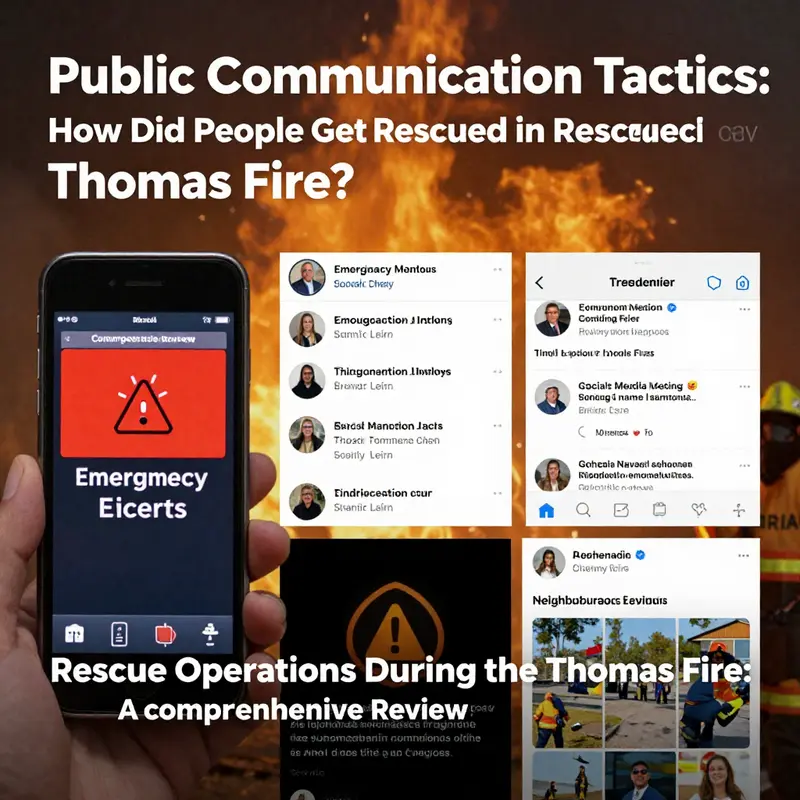
Public communication was the lifeline that turned firefighting resources into real rescues during the Thomas Fire. The fire’s rapid spread, driven by Santa Ana winds and dry vegetation, created a chaotic emergency. In that chaos, the ability to quickly warn, guide, and coordinate people determined who escaped safely and who needed direct rescue. The response did not hinge on a single system; it relied on layered, redundant messaging delivered through broadcast media, targeted phone alerts, social platforms, door-to-door contact, and community networks. Those layers worked together, often in seconds, to move hundreds of thousands of people away from danger and to funnel urgent needs to response teams. The backbone of mass notification was traditional broadcast through the Emergency Alert System. Television and radio provided continuous updates on evacuation orders, road closures, and shelter locations. Broadcasters extended live coverage, carrying official feeds and situational reports. For many residents, especially older adults, this remained the most trusted and accessible source of information. When power and cell service were intact, the EAS provided a simple, hard-to-ignore channel to relay sweeping evacuation directives. At the same time, agencies used reverse 911 calls to reach people in specific neighborhoods. These automated calls were tailored to precise geographic zones and carried mandatory evacuation instructions when needed. That geographic targeting mattered: it reduced confusion about who needed to leave immediately and who had time to prepare. Reverse 911 also allowed operators to provide clear, short steps — what to take, which roads to avoid, and where to find shelters. For residents who answered, those calls were decisive prompts to act. Social media transformed how information moved during the Thomas Fire. Fire agencies and local governments used platforms to push live updates, maps, and links to shelter information. Social channels delivered fast spot reports from crews on the ground. They also allowed two-way exchanges: residents posted images and videos that helped officials verify fire movement and blocked roads. This crowd-sourced situational awareness helped incident commanders reallocate resources and adjust evacuation boundaries. Social posts could spread rapidly across networks, reaching people beyond official subscriber lists. Their reach made them indispensable for urgent situational updates. But social media also created challenges. Misinformation and unverified field reports circulated quickly. Officials invested in clear, branded channels to reduce confusion. They asked the public to rely on verified accounts for evacuation orders and to report emergencies through official lines rather than open feeds. The principle was simple: amplify verified official messages and use community posts to complement them, not replace them. Door-to-door notification remained crucial, especially where digital reach lagged. Firefighters, law enforcement, and volunteers physically alerted people who were asleep, bedridden, or disconnected. These knock-and-evacuate operations focused on the most vulnerable—residents with mobility limitations and those in isolated homes. Door-to-door contact ensured that evacuation orders reached people who might otherwise have been missed by automated systems. It was time- and labor-intensive, but in many neighborhoods it saved lives. A less formal but powerful channel was the emergence of community narratives and acts of local heroism. Videos and stories of neighbors helping neighbors—like the viral clip of a young man rescuing a rabbit—amplified safety norms. These narratives reinforced official messaging. They offered simple models of safe assistance: help others only when it is safe, alert authorities to trapped people, and follow evacuation routes. Community stories also galvanized volunteers and illuminated small but important behaviors that scaled into widespread protective action. Communication also meant moving people physically and managing logistics. Public messages pointed residents toward evacuation routes and shelters. Transportation for those without vehicles was coordinated through agencies and community groups. At staging areas, staff communicated continuously about shelter capacity, medical services, and reunification processes. Clear signage and on-site announcements reduced panic and streamlined intake. For people with medical needs, special registries and pre-identified care plans enabled responders to prioritize transport and shelter placement. Multilingual messaging was a persistent priority. The affected communities were linguistically diverse. Authorities translated alerts and staffed hotlines with bilingual operators. These measures reduced language barriers and improved the reach of evacuation instructions among non-English speakers. Translators and culturally informed outreach workers were often the bridge between official directives and community compliance. Technical systems supported the human actions. GIS mapping and geotargeted alerts allowed precise evacuation zones. Incident command centers used up-to-date mapping overlays to send targeted messages. That same mapping informed traffic control plans, helping prevent gridlock on evacuation routes. Meanwhile, aerial teams and ground crews relayed conditions to command centers, and that intelligence fed public advisories. The result was a continuous loop: field observations shaped public messaging, and public reports refined situational awareness. Redundancy was deliberate. Officials recognized that no single channel could be relied on amid power outages and network congestion. They layered alerts—EAS, phone calls, social posts, highway signs, and door-knock teams—to ensure messages reached people by at least one route. This redundancy tilted outcomes toward safety, particularly when a resident missed one alert but received another. Yet the communication effort revealed gaps. Some notification systems struggled to reach those in care facilities and assisted living. For some seniors, mobility issues and delayed transfers left them dangerously exposed. These shortcomings prompted scrutiny and calls for improved alert protocols for congregate care settings. Debriefing after the fire highlighted weaknesses in coordination between agencies and facility managers. It also emphasized the need for routine drills and clearer lines of responsibility. Power outages and overloaded cell networks complicated matters. Backup power and alternative communications—such as amateur radio operators—played supporting roles. Community emergency response teams and volunteers used battery-powered radios and printed maps to bridge gaps. Pre-established meeting points and simple evacuation checklists also helped households act decisively when digital systems failed. The Thomas Fire underscored the value of public engagement before a crisis. Communities with higher awareness of evacuation plans responded faster. Outreach campaigns that taught residents how to prepare grab-and-go kits, plan routes, and identify neighbors with special needs created a culture of readiness. Those preparations reduced hesitation when alerts arrived. Prepared households left more quickly, and shelters and responders could focus on those who truly needed help. Finally, the fire emphasized a broader lesson: communication must account for cascading hazards. The burn scar left by the fire increased the risk of post-fire mudslides during subsequent rains. Public messaging had to evolve from immediate fire evacuation to longer-term warnings about debris flows and unstable slopes. This multi-hazard approach required new alert templates and coordination with agencies responsible for flood and landslide risks. The Thomas Fire’s rescue story was not just about trucks and planes. It was about how information reached people at the right moment. When broadcast alerts, targeted calls, social updates, and boots on the ground converged, they created pathways to safety. Where those systems faltered, the consequences were stark. The events prompted practical changes: improved alert protocols for vulnerable groups, more robust multilingual outreach, better integration of social media into official reporting, and strengthened redundancy in notification systems. Those changes aim to make future evacuations faster, clearer, and safer. For a concise account of the fire’s scale and timeline, see the Thomas Fire summary on Wikipedia: https://en.wikipedia.org/wiki/Thomas_Fire. For deeper analysis of notification gaps and how alert systems failed or succeeded in California wildfires, review this discussion of California wildfire alert failures: California wildfire alert failures.
Saving Whole Neighborhoods: How Firefighting Resources Rescued People in the Thomas Fire
A coordinated shield against the flames. When the Thomas Fire raced across Southern California in December 2017, the rescue of people was not the work of a single agency or tactic. It was the product of layered resources, rapid communication, and countless improvisations by trained professionals and neighbors alike. That mix of formal emergency systems and immediate human action determined who got out alive, and how fast entire communities were moved out of harm’s way.
Authorities began with evacuation orders, and those orders were the pivot of rescue. Mandatory evacuation notices flowed from county and city officials across Ventura and Santa Barbara counties. Officials used the Emergency Alert System, reverse 911 calls, local media, and social media, and they sent teams door to door when crews could reach neighborhoods. These alerts had to travel faster than the fire, and they largely did. At the fire’s peak, over 300,000 residents were ordered or advised to leave. The scale made clear that rescue was not only about extracting people from buildings. It was about moving populations, managing traffic, and preventing gridlock so emergency vehicles could reach vulnerable pockets.
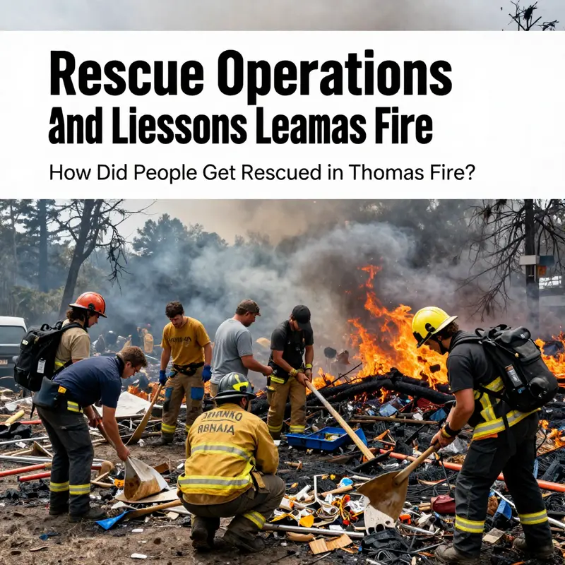
On the ground, thousands of firefighters from state and federal agencies formed the backbone of rescue operations. State firefighters, local fire departments, U.S. Forest Service crews, and mutual aid partners worked side by side. They did more than fight fires. They made tactical rescues when flames boxed in neighborhoods. In places where roads were choked with smoke or blocked by debris, fire crews improvised. They used all-terrain vehicles, bulldozers to clear access, and engines as mobile line-of-defense points. When roads were impassable, small teams navigated narrow residential lanes to knock on doors and move residents out.
Aerial resources were decisive. Helicopters slung water into fire lines, but they also relocated people in extreme situations. In isolated canyon communities and heavily threatened neighborhoods, helicopters evacuated residents who could not reach safe roads. Pilots performed hoist rescues and landings on cleared roadways or open spaces. Air tankers dropped retardant to blunt the fire’s spread and buy time for ground crews to reach and shepherd people to safety. The synergy between air and ground assets often turned what would have been an impossible escape into an orderly evacuation.
Rescue became logistics. Opening emergency shelters and support centers created places for evacuees to regroup. Local governments converted school gyms, community centers, and fairgrounds into shelters offering food, medical care, and information. These sites were not passive refuges. They were command points where law enforcement, public health teams, and social services worked to reunite families, register evacuees, and route those with special medical needs to appropriate care. Shelters became hubs for continuing evacuation management and community calm.
Vulnerable populations shaped rescue decisions. The elderly, people with disabilities, and those in care facilities required individual plans. Firefighters and emergency managers prioritized these residents when possible. In some cases, specialized transport arranged by county health and social services carried residents by ambulance or bus. But the scale of the Thomas Fire exposed gaps. Some care facilities and assisted-living settings struggled to evacuate quickly, highlighting how planning must account for mobility limits and medical dependencies.
Community response amplified formal rescue. Neighbors helped neighbors, sharing vehicles and shelter space. Volunteers spread word through community networks. Local businesses opened their doors to displaced families and pets. Churches and nonprofit organizations set up hotlines and supply distribution. That volunteer muscle often bridged delays between evacuation orders and formal transport, especially in remote neighborhoods where agency access lagged due to terrain or fire activity.
Coordination across agencies was constant. Incident command structures facilitated information flow between firefighting crews, law enforcement, public works, and emergency medical services. Unified command enabled shared situational awareness. Dispatchers rerouted mutual aid as conditions changed. This structure allowed rapid resource shifts—when winds turned, when a new fire front developed, when roads closed—and it kept rescue efforts adaptive and targeted.
Technology and information systems also played a role. Digital mapping and real-time incident tracking helped identify threat corridors. Social media and official websites provided updates about evacuation zones and shelter locations. Yet the event also exposed alert system weaknesses. Not every resident received a timely message, and some alerts reached people who had already evacuated, creating confusion. These gaps underscored the need to refine systems and reach the people who are most isolated or who lack digital channels.
Danger forced improvisation. In several rescues, firefighters abandoned the goal of containment to focus on extraction. Crews accepted calculated risk to get people out before flames reached structures. In other situations, law enforcement coordinated traffic flows to prevent bottlenecks on the narrow coastal and canyon roads. Sometimes, evacuation meant guiding cars along alternate routes and through smoky corridors where visibility was low. Search-and-rescue teams swept communities to find anyone who had remained behind.
Medical response was woven into rescue operations. First responders stabilized injured or smoke-inhalation patients on site, then moved them to field triage or hospitals. Ambulances and medical transport coordinated with shelters to match patients’ needs. Mental health teams and social workers arrived soon after to address shock and disorientation. These services helped mitigate long-term trauma and allowed displaced residents to understand next steps after immediate rescue.
Logistics of fuel, food, and rest sustained rescue teams. Firefighting is physically brutal work, especially under Santa Ana wind conditions. Agencies set up relief rotations, feeding stations, and rest areas for crews. That support kept engines working and teams ready to launch new rescues. Without reliable logistics, initial gains can quickly evaporate as crews fall back from exhaustion.
After the flames, the hazard did not end. Burn scars increased runoff risk, and subsequent storms triggered mudslides. Post-fire rescue shifted toward search and recovery and protection from secondary threats. Local officials issued new warnings and evacuation advisories for mudslide-prone zones. Those follow-up alerts were essential because rescue now meant preventing additional injuries from post-fire landscape instability.
The Thomas Fire showed that rescue in a megafire hinges on collaboration, flexibility, and community action. Firefighting assets—aircraft, engines, bulldozers, and crews—bought time. Evacuation systems and shelters provided structure. Community volunteers and neighbors filled critical gaps. Yet the disaster also exposed vulnerabilities: alert reach could fail, care facilities needed stronger evacuation plans, and geographic constraints limited access.
Lessons from the Thomas Fire point to practical improvements. Strengthening multi-agency drills, expanding alert redundancy, and creating pre-identified evacuation routes for high-risk neighborhoods reduce rescue delays. Investing in transport solutions for people with limited mobility and improving shelter medical capacity ensure that vulnerable populations are not left behind. Finally, community preparedness training can multiply the effect of formal rescues, turning neighbors into first responders when official resources are stretched.
The Thomas Fire rescue story is complex. It mixes heroism and improvisation, planning and shortfalls. Above all, it demonstrates that saving people in a large-scale wildfire requires many layers of response operating together. Each layer—alerts, aircraft, ground crews, shelters, and neighbors—was essential. When one held, it allowed the others time to act. Where gaps existed, planners now have the data to close them, so the next community facing a similar inferno doesn’t have to rely on luck.
For more official incident details and timelines from the fire response, see the California Department of Forestry and Fire Protection’s Thomas Fire page: https://www.fire.ca.gov/incidents/2017/12/04/thomas-fire/
Read more about how planning and response gaps affected operations during the event at California wildfire emergency planning failures.
Rescues in the Wake: Post-Fire Rescue Operations and the Thomas Fire’s Aftermath
When people ask how rescue unfolded during the Thomas Fire, they often imagine a single, decisive theatre of action: flames marching through brush, sirens wailing, and civilians guided to safety by crews in the heat of the moment. But the Thomas Fire narrative extends beyond the last ember, into a complex, layered sequence of responses that continued to save lives even after the flames were spent. The core rescue story is one of adaptability, relentless cooperation, and the quiet, persistent work of keeping communities informed and accessible in the wake of ruin. It also reveals how a wildfire’s true danger can persist long after it is declared contained, when rainfall can turn scorched hillsides into unstable debris fields and once-fugitive paths into lethal mazes. The rescue record shows not only heroic acts of courage in the moment, but the careful orchestration of plans, people, and procedures that future risk analyses would insist on for burn-scarred landscapes.
The Thomas Fire began in early December 2017 and grew with extraordinary speed, fed by gusty Santa Ana winds and bone-dry fuels. Across Ventura and Santa Barbara Counties, emergency managers marshaled an enormous force: thousands of firefighters, significant aerial support for direct suppression and reconnaissance, and a multifaceted communication network that tried to reach hundreds of thousands of residents under stress. Ground evacuations were sweeping and rapid, delivered through channels that included reverse-911 alerts, local news, social media, and door-to-door notifications in neighborhoods where streets were tight and visibility limited. In those hours and days, the rescue calculus was straightforward in principle: move people out of harm’s way, minimize exposure, and sustain access to essential services. Yet the reality was far more intricate. The landscape across the burn zones is not a flat plain but a maze of canyons, foothills, and ridges that could trap someone within minutes if roadways were blocked or smoke limited visibility. The rescue teams learned quickly that speed must be matched by precision; a rapid evacuation could become a perilous bottleneck if evacuees remained in vulnerable locations or if routes became compromised by shifting conditions.
As the fire advanced, the immediate rescue picture was defined by a highly coordinated, multi-agency response. Firefighters directed suppression efforts to create defensible spaces, while law enforcement and public safety agencies managed evacuation zones and traffic flow. Medical and social services personnel stood ready to triage needs at shelters and support points, recognizing that the most vulnerable residents—families with young children, the elderly, and those with mobility challenges—faced special risks when routes closed or shelters filled. The operational tempo required continuous information exchange and flexible resource deployment. In this sense, the rescue effort mirrored a carefully choreographed relay: initial alerts to warn and move people; rapid ground and aerial operations to reach those stranded by the advancing flames; and the early, ongoing coordination necessary to keep routes open, fuel the evacuation with transportation and shelter capacity, and preserve access to medical care.
Yet even this monumental phase of rescue was not the end of danger. When the fire finally burned down and containment lines began to hold, a new and often more insidious threat emerged: debris flows and mudslides triggered by the loss of vegetation and the sudden deluge of winter rains. The burn scar’s hydrophobic soils and uprooted root networks created a precarious layer of sediment and rock that could surge downhill with little warning. This secondary hazard would claim lives and complicate the recovery era, demanding quick adaptation from responders who had just finished the most intense firefighting operations. The post-fire period demanded a new kind of situational awareness: understanding that stability in the landscape did not automatically translate into safety for residents still living in or near vulnerable zones. In January 2018, when conditions were right for heavy rain, teams faced the daunting task of reaching people whose homes had been swallowed by flash floods, or whose access routes had been buried beneath collapsing debris.
It was in this context that helicopter rescues again became essential. On January 9 and 10, 2018, just months after the fire had been brought under control, aerial teams conducted hoist rescues to extract over 120 residents from areas that had become inaccessible due to mudslides and landslides triggered by the loss of vegetation. These operations were conducted under perilous conditions: shifting slopes, unstable debris, and the ongoing risk of additional slides that could obstruct landing zones or strand rescuers themselves. The rescues required precise coordination between pilots, rescue technicians, and ground crews who could identify viable landing sites, assess the stability of the surrounding terrain, and manage the flow of evacuees to safer locations. The work demanded not only technical skill but also an extraordinary degree of judgment about risk versus payoff. The crews performed under conditions that strained even seasoned responders—unpredictable weather, the haunting possibility of another slide, and the pressure of saving lives in a landscape that remained fragile in the aftermath of the fire.
The broader post-fire hazard became clearer with time and data. Debris flows were a major cause of fatalities associated with the Thomas Fire event; the losses in the burn scar areas underscored that the danger persisted beyond the visible signs of heat. As of April 2023, records indicated 23 deaths linked to post-fire debris flows, illustrating the long arc of risk that follows a wildfire and the need for preparedness that extends into the weeks and months after the flames are out. This grim statistic reframes the rescue narrative from a moment in time to a continuum of protection that must begin before a fire starts and continue after it ends. It is a reminder that resilience is not measured solely by how quickly people escape a blaze but also by how effectively communities anticipate and mitigate secondary hazards that can arise from the landscape’s sudden transformation after fire.
The lessons drawn from this sequence of events are precise and actionable. First, the need for an early warning system for debris flows is critical. The Thomas Fire aftermath showed that warning signals, when timely and accurate, can buy vital minutes for residents to evacuate before a slide roars down a hillside. Such warnings must be integrated with real-time monitoring of soil saturation, rainfall intensity, and burn-scar stability, and they must be communicated in ways that reach people who may have already fled during the blaze or who remain in high-risk zones due to unavoidable circumstances. Second, the communication channels used during the initial evacuations must be maintained and strengthened for the post-fire period. The public needs clear guidance about when to shelter, where to relocate, and how to avoid risky areas that might be prone to sudden debris flows. The Thomas Fire experience highlighted how critical it is to propagate information through multiple channels—text alerts, media briefings, social media updates, and direct outreach to households with special needs—all while acknowledging that some residents may lack access to certain platforms. Third, land-use planning and landscape restoration play indispensable roles in reducing vulnerability. Restoring vegetation and stabilizing slopes is not merely a matter of aesthetics; it is a practical investment in mitigating future debris flows and protecting communities in the urban-wildland interface. In the years since the Thomas Fire, jurisdictions have pursued debris basins, retention structures, and targeted hillside stabilization projects designed to intercept and slow potential flows before they reach populated areas. These infrastructure solutions, when combined with proactive evacuation planning, can reduce the risk to residents and buy time for life-saving responses when weather conditions threaten the same burned terrains again.
A more integrated approach to rescue and recovery is necessary for communities facing similar hazards. TheThomas Fire experience demonstrates the value of cross-agency collaboration—fire, law enforcement, emergency management, public health, and local governments must speak with one voice to ensure that messages are consistent and that resources are allocated where needed most. The kind of unified command that allowed hundreds of thousands to evacuate quickly under extreme pressure also provides a blueprint for addressing post-fire dangers. In practice, this means rehearsed protocols for post-disaster reconnaissance, coordinated search and rescue, and a shared situational picture that reflects both the immediate danger and the longer-term risk profile of the landscape. It also means sustaining the connection between responders and residents through community outreach and education—ensuring that people understand not only how to leave a hazardous area, but how to recognize warning signs that could portend a new threat once the fire is out.
The Thomas Fire’s rescue narrative is a testament to resilience built on preparation, communication, and adaptable operations. It underscores the idea that saving lives is a continuous process: it begins with early, decisive action to remove people from danger; it extends through the painstaking logistics of providing shelter, medical support, and mobility options; and it continues with the vigilant management of post-fire hazards that require rapid escalation of response in the face of new threats. For communities facing similar risks, the lessons are clear and actionable. Invest in robust evacuation planning that anticipates high-volume movement, implement multi-channel alert systems that reach every resident, and maintain ready-to-deploy resources for both firefighting and post-fire stabilization. Prioritize debris-flow monitoring and hillside stabilization to reduce future tragedies, while building a culture of preparedness that emphasizes both speed and prudence. In other words, rescue during the Thomas Fire was not a single act but a continuum of care that stretched from the blaze through the landscape’s slow, dangerous healing.
For readers seeking a deeper, map-based chronicle of the fire and its aftermath, the interactive timeline published by CAL FIRE provides a geographic overview that complements this narrative. It offers a detailed sense of how responses evolved across different communities and how the terrain shaped both risk and rescue opportunities. See the California wildfire emergency response for seniors resource for related discussion of how vulnerable populations are prioritized in evacuations and post-fire operations. California wildfire emergency response for seniors.
As this chapter closes on the Thomas Fire, it points toward a broader understanding of disaster response: preparedness, rapid, coordinated action, and a careful attention to secondary hazards are essential to truly protecting communities. The story of the Thomas Fire’s rescues—first on the ground, then in the air, and finally in the landscape’s recovery—illustrates how resilience is built, step by step, through planning that never stops at containment but continues into every subsequent challenge the land may present.
External resource: for a detailed interactive timeline and geographic overview of the Thomas Fire and its aftermath, see the CAL FIRE StoryMap: https://storymaps.arcgis.com/stories/4b1f6a7c4d4a4a5e9d1e4d6d4a4d4a4d
Final thoughts
The Thomas Fire serves as a crucial case study in disaster response and community resilience. The strategies employed during the rescue operations illustrate the importance of coordinated efforts, effective communication, and the dedicated work of emergency services. As communities continue to face the reality of wildfires, the lessons learned from the Thomas Fire can significantly enhance future preparedness and response systems. The collaborative actions taken during such crises not only save lives but also strengthen the fabric of our communities, emphasizing the need for continuous improvement in emergency management.